 Image
Image
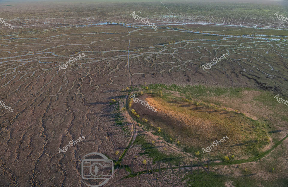
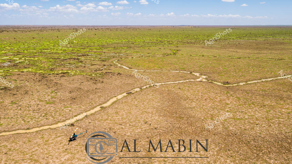
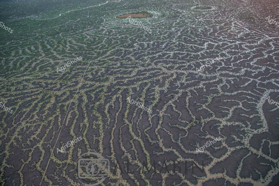
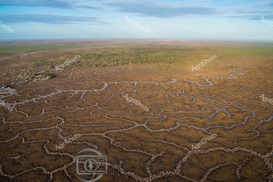
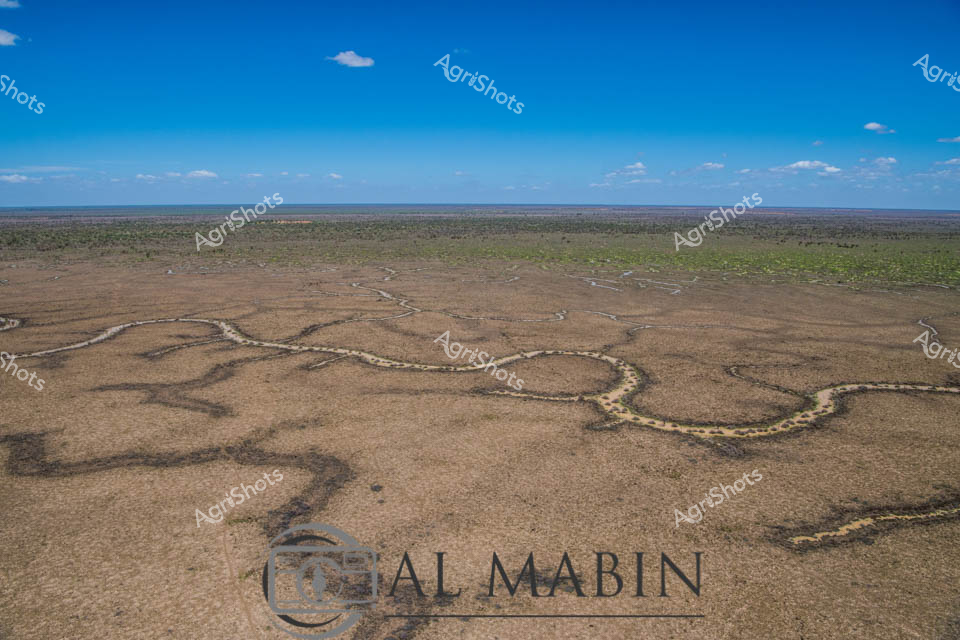
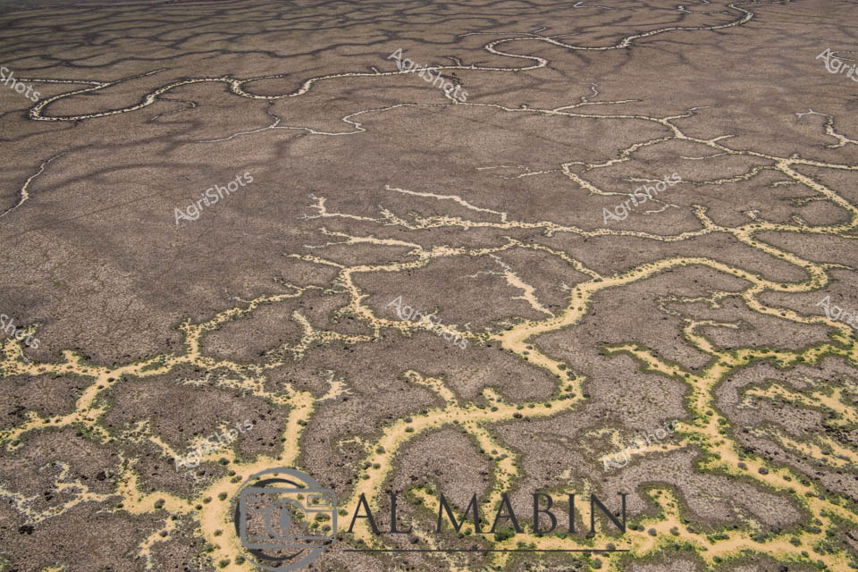
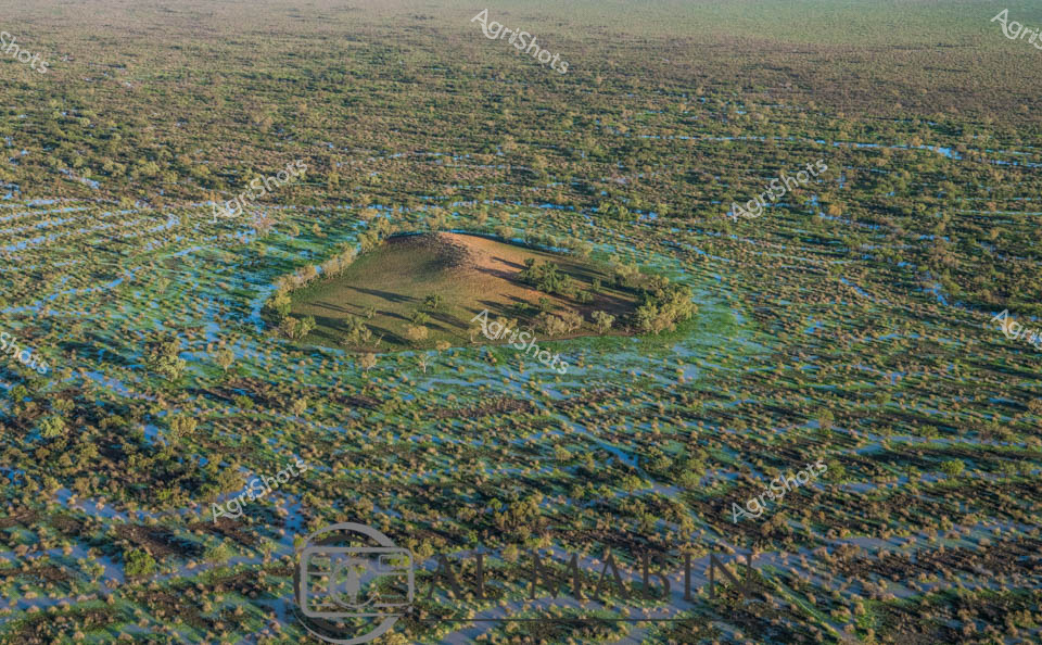
Aerial panorama of Channel Country's mesmerizing floodplain landscape in remote Queensland, revealing an intricate network of ephemeral waterways weaving across arid terrain. Sinuous blue channels snake through sun-baked earth, creating a complex hydrological tapestry that sustains vast pastoral stations during seasonal inundations. A subtle raised landform emerges, edged with sparse vegetation - likely a strategic cattle station vantage point positioned to monitor livestock movements during critical flooding periods. The landscape displays a sophisticated natural irrigation system, where seasonal rains transform this seemingly harsh environment into a dynamic ecosystem supporting extensive beef production. Muted earthy tones of ochre, dusty brown, and subtle green blend seamlessly, showcasing the resilient adaptability of Queensland's agricultural landscape. This remarkable aerial perspective captures the delicate balance between water, land, and agricultural management in one of Australia's most challenging yet productive pastoral regions.
 Image
Image
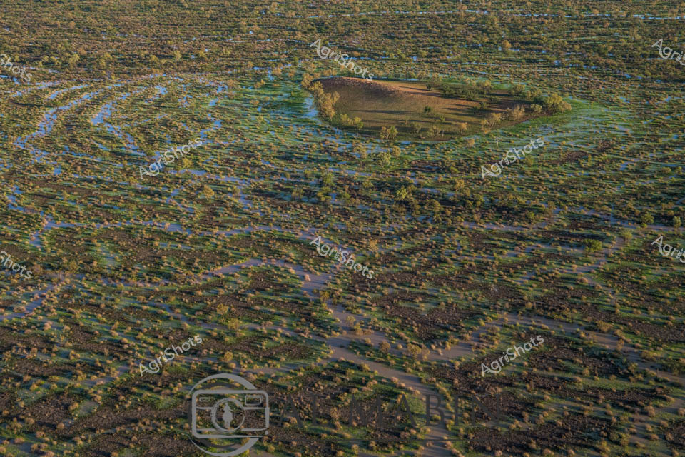
Aerial view of Channel Country, Queensland, revealing nature's intricate water management system. Serpentine channels carved into the arid landscape create a mesmerizing network of dry creek beds and ephemeral waterways, stretching across a vast, undulating terrain. The intricate patterns resemble delicate veins etched into the earth's surface, a testament to the power of water in shaping this harsh desert environment. Sparse vegetation clusters around the edges of these natural channels, hinting at the resilience of life in this challenging ecosystem. The landscape transitions from rich brown earth in the foreground to muted greens and distant horizons, under a soft blue sky dotted with wispy clouds. This image captures the raw beauty of Australia's inland water systems, showcasing how even in the driest conditions, water finds its path across the landscape, creating lifelines for the region's unique flora and fauna.
 Image
Image
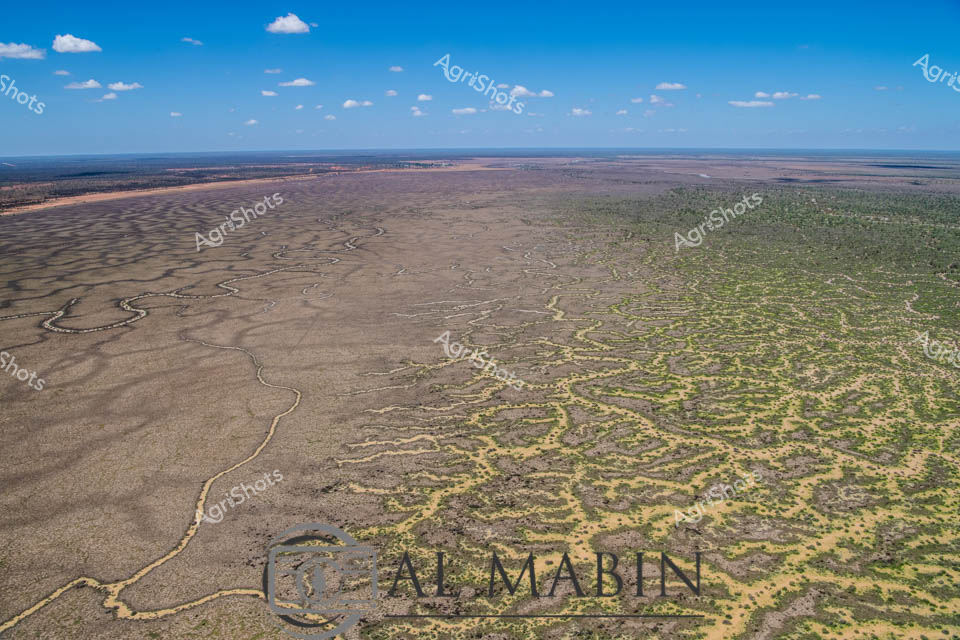
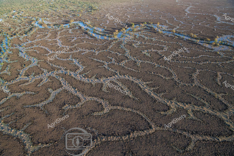
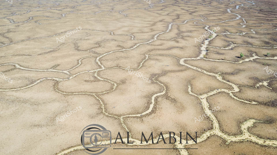
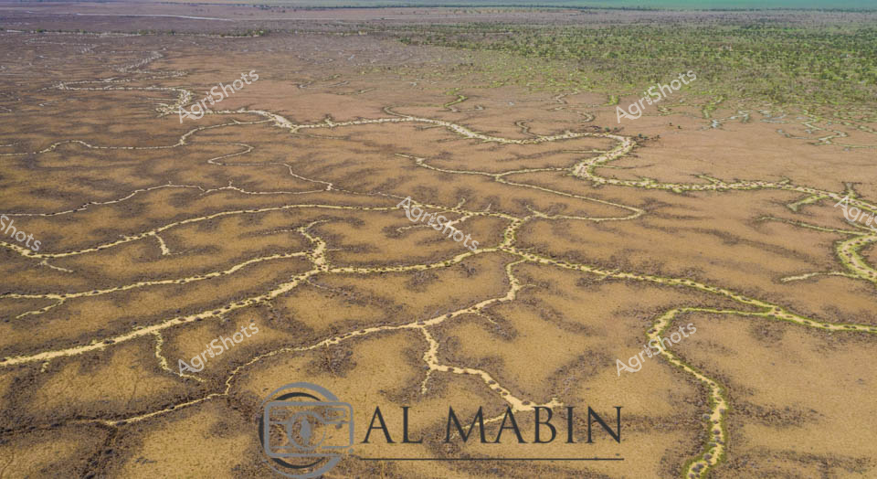
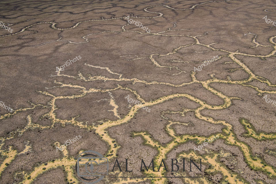
Serpentine waterways trace golden-brown earth like delicate veins across the expansive Channel Country landscape. Aerial perspective reveals the intricate network of ephemeral creek lines spreading across the arid Queensland landscape, where subtle green vegetation marks the moisture-rich pathways. The seasonal flooding has transformed the dusty plains into a complex hydrology of interconnected waterways, highlighting the dramatic seasonal transformations of Australia's inland pastoral regions. Windorah's distinctive landscape unfolds in earthy ochres and muted greens, showcasing the resilient ecosystem of remote western Queensland. Subtle variations in terrain create a mesmerizing topographic pattern, where water's ancient pathways carve intricate routes through the station country. The image captures the breathtaking scale and delicate ecological balance of Australia's inland water systems, where every rainfall and flood cycle reshapes the terrain in a timeless dance of renewal and survival.
 Image
Image
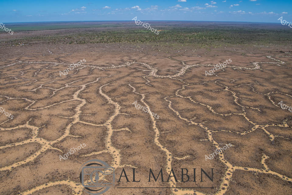
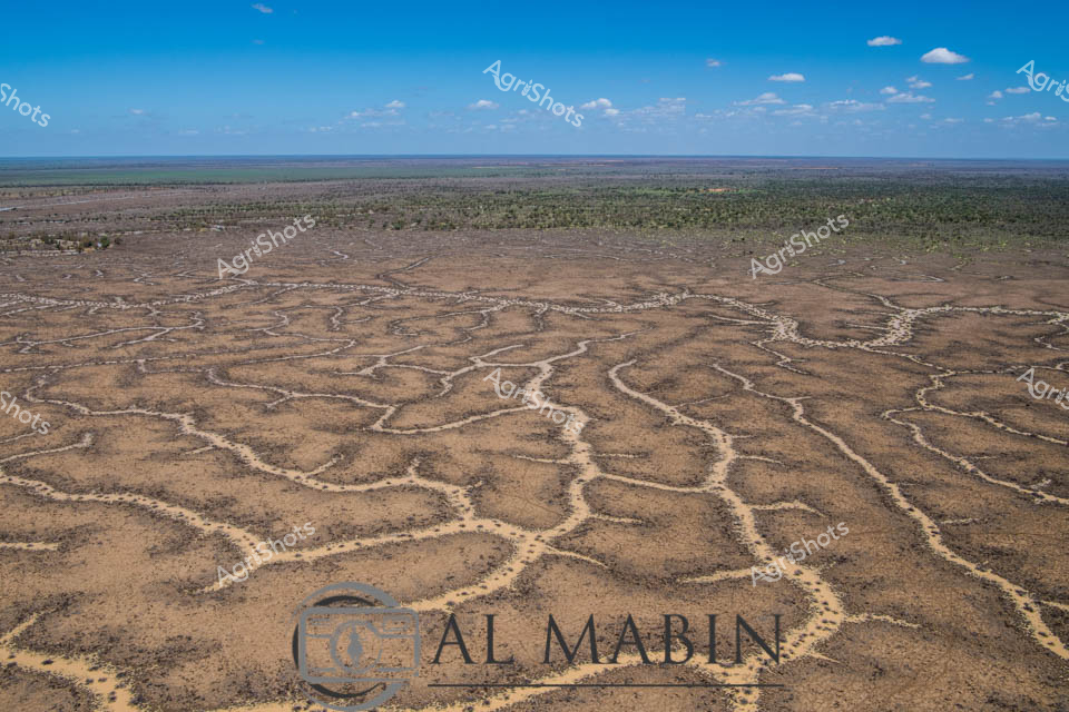
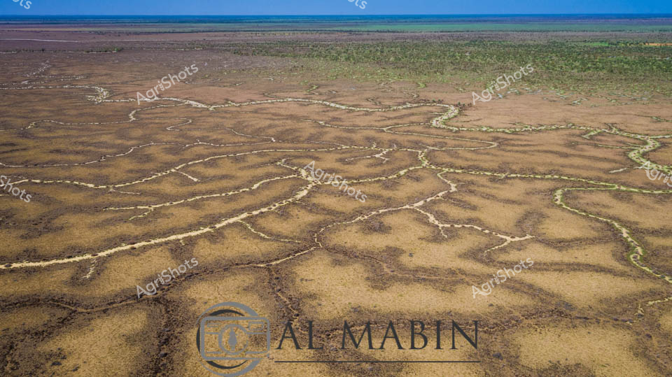
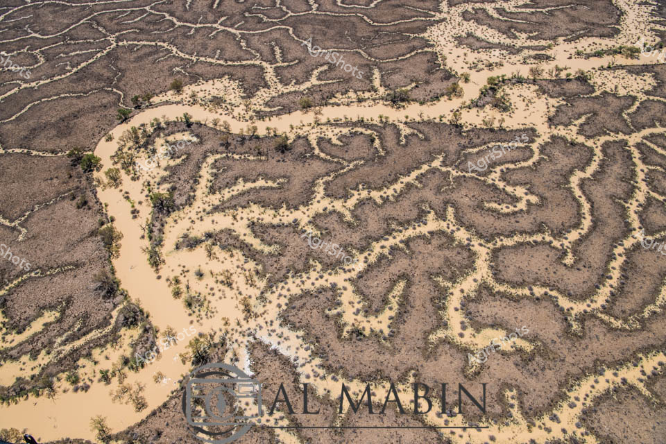
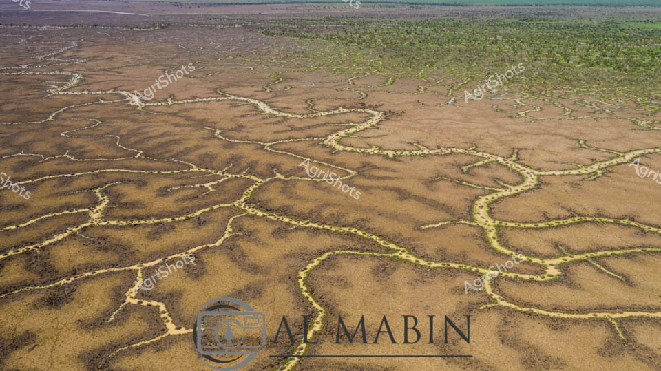
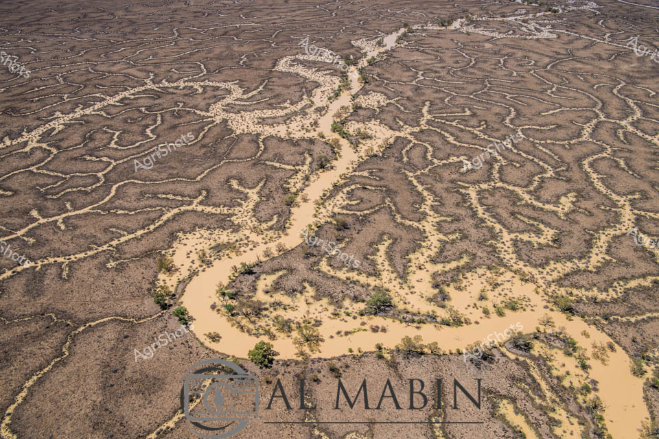
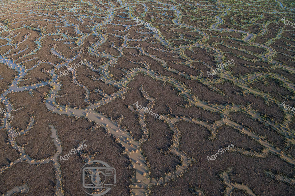
An intricate aerial view of Channel Country reveals a complex network of braided waterways and dry creek beds stretching across an arid Queensland landscape. Serpentine rivers wind through the parched terrain, creating an organic, maze-like pattern of silver and ochre channels that reflect the unique hydrology of this remote Australian outback region. The landscape captures the harsh beauty of drought-affected inland Australia, with sparse vegetation and meandering water courses etched into the sun-baked earth.
 Video
Video
This video footage captures a stark, arid landscape revealing the harsh realities of drought conditions in an Australian agricultural region. The scene presents a parched, cracked earth with intricate, serpentine patterns of dried and yellowed vegetation winding across the barren ground. The color palette is predominantly muted browns and dusty tans, highlighting the extreme dryness of the terrain. The clip appears to document the devastating impact of prolonged water scarcity on a rural landscape, potentially in a region like South Australia or Queensland. Sparse, withered vegetation traces delicate, almost fractal-like patterns across the ground, creating a sense of desolation and environmental stress. These dried vegetation trails contrast against the uniform, baked earth, illustrating the challenging conditions faced by farmers and ecosystems during severe drought periods. The video seems designed to capture the raw, unfiltered reality of agricultural landscapes during water shortages, providing a powerful visual narrative about climate resilience and the environmental challenges confronting Australian farming communities. The stark, minimalist composition emphasizes the profound environmental transformation wrought by extended periods without adequate rainfall. The footage powerfully communicates the vulnerability of agricultural landscapes to climatic extremes, serving as a critical documentation of environmental change and rural adaptation strategies.
 Image
Image
Expansive Channel Country floodplain stretches toward the distant horizon, revealing the raw beauty of Queensland's interior landscape. A sinuous dry creek bed meanders across the sun-drenched terrain, its pale sandy path cutting through muted earth tones of brown and subtle green. Intermittent patches of bright green vegetation suggest recent rainfall has brought fleeting life to this arid pastoral region, highlighting the delicate ecological balance of Australia's inland stations. The wide blue sky, populated with soft white clouds, creates a sense of immense openness and potential, characteristic of the vast beef production areas of western Queensland. The watermark of Al Mabin, a renowned agricultural photographer, anchors the image, signaling this as a professional documentation of the challenging and beautiful landscapes that sustain Australia's cattle industry. The composition captures the resilience of the landscape - a network of natural watercourses waiting to be activated by seasonal floods, ready to transform this seemingly dormant terrain into a momentary oasis of pastoral productivity.
 Image
Image
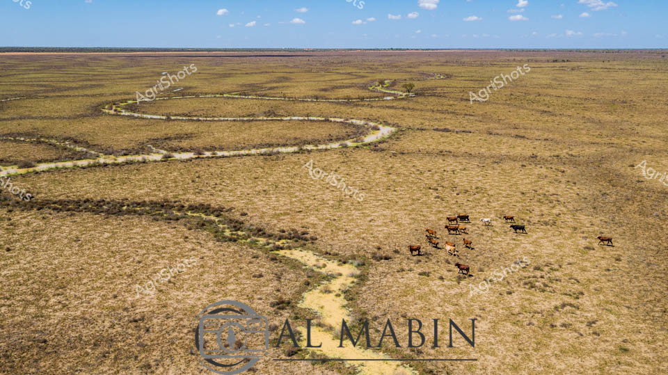
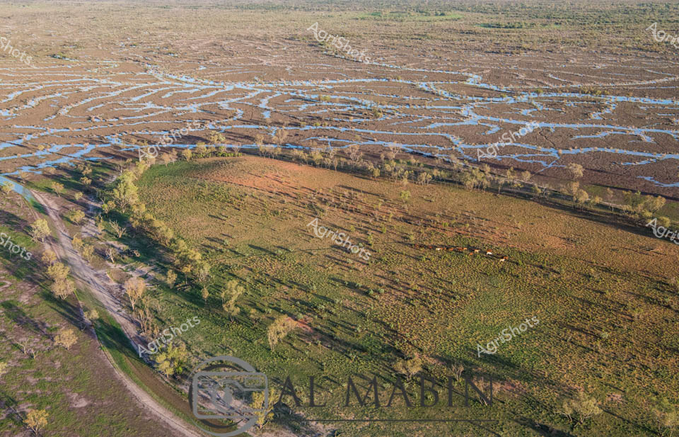
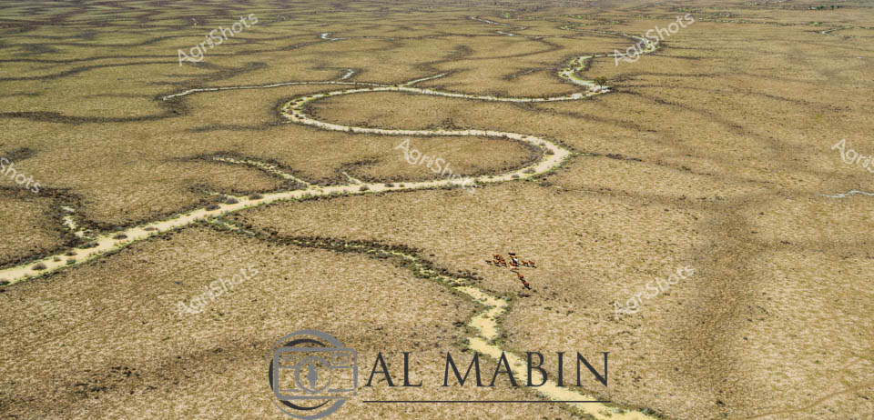
Meandering through the expansive Channel Country of Queensland, a serpentine waterway cuts a vibrant path across the golden-brown grasslands, breathing life into the arid landscape. A small herd of robust beef cattle graze near the water's edge, their rich brown coats contrasting against the sun-bleached pastures, embodying the resilience of Australian livestock in this challenging environment. The winding creek, likely swollen from seasonal flooding, creates a lifeline through the seemingly endless horizon, its banks lined with subtle hints of green vegetation marking the water's influence. The aerial perspective reveals the magnificent scale of this remote pastoral setting, where the sky stretches endlessly in soft blue hues dotted with wispy clouds. The landscape speaks to the harsh yet beautiful nature of outback Queensland, where survival depends on strategic water management and adaptable cattle breeds. The subtle watermark of "Al Mabin" suggests this is a carefully captured moment documenting the agricultural heritage of the region, highlighting the intricate relationship between land, water, and livestock in one of Australia's most challenging agricultural frontiers.
 Image
Image
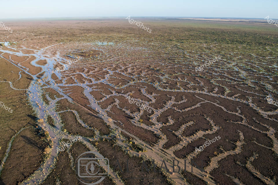
Aerial vista of Channel Country's intricate water management system, revealing the complex network of ephemeral creek channels carved across an arid Queensland landscape. Serpentine waterways weave like silvery veins across the dusty earth, creating an extraordinary natural irrigation pattern that transforms during rare flooding events. The branching channels, etched delicately into the ochre and sienna terrain, demonstrate the remarkable hydraulic engineering of this remote Australian pastoral region. Distant green vegetation marks the landscape's edges, contrasting against the pale brown ground and meeting a luminous azure sky scattered with wispy white clouds. These natural water distribution channels are critical infrastructure for beef cattle stations, capturing and dispersing precious rainfall across vast, otherwise inhospitable plains. The image captures the extraordinary resilience and adaptive strategies of Australian agricultural landscapes, where water management is an art form sculpted by geological and climatic forces.
 Image
Image
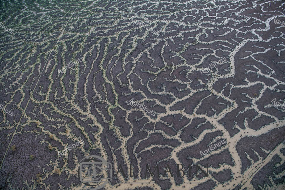
Aerial view of intricate water channels spreading across an arid Queensland landscape, capturing the mesmerizing patterns of flood irrigation in Channel Country. Sinuous lines of water weave through dark and green-tinted earth, creating a natural labyrinth that resembles delicate veins across the barren terrain. The complex network of waterways reveals the transformative power of seasonal flooding, where ephemeral rivers and creeks spread nutrients and moisture across the harsh outback landscape. Subtle gradients of green, brown, and grey blend together, showcasing the delicate balance of water management in Australia's remote beef production regions. This extraordinary perspective highlights the resilience of pastoral landscapes, where strategic water distribution enables livestock grazing in some of the continent's most challenging environments. The image captures the raw beauty of Queensland's inland hydrology, where every water channel represents a lifeline for agricultural survival in an unforgiving ecosystem.
 Image
Image
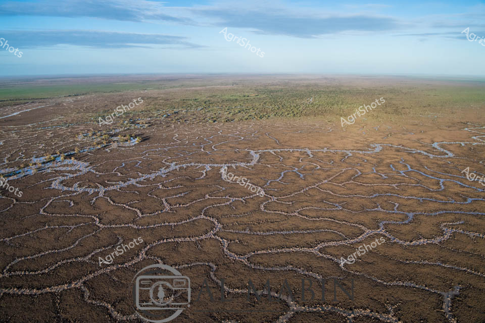
Serpentine waterways carve intricate patterns across the arid Channel Country landscape, revealing the ephemeral life force of inland Queensland. Flooding creek systems spread like delicate silver veins across the ochre and umber terrain, creating a natural irrigation network that transforms the drought-stricken earth into a temporary emerald and bronze tapestry. The horizon stretches endlessly, with a deep azure sky meeting the weathered plains, highlighting the dynamic ecosystem of this remote pastoral region. These branching water channels, characteristic of western Queensland's unique geography, demonstrate the critical role of seasonal water flows in sustaining pastoral stations and supporting fragile desert ecosystems. The aerial perspective captures the raw beauty of Australia's inland hydrology, where water becomes a sculptural element reshaping the landscape with each seasonal pulse. The Al Mabin watermark subtly acknowledges the photographic documentation of this remarkable environmental phenomenon, preserving the intricate choreography of water and land in one of Australia's most challenging agricultural environments.
 Image
Image
Aerial panorama of Channel Country in western Queensland during flood season, where intricate blue waterways weave across the ochre landscape like delicate capillaries. Lush green pastures curve alongside serpentine water channels, creating a mesmerizing natural tapestry that epitomizes the dynamic ecosystem of Australia's inland pastoral regions. Sparse eucalyptus trees punctuate the floodplain, their silvery-green foliage providing subtle texture against the expansive brown and blue terrain. This extraordinary vista captures the resilience of beef cattle stations during seasonal inundation, where strategic water management transforms seemingly arid landscapes into temporary aquatic networks that nourish grasslands and sustain livestock production. The image reveals the breathtaking scale of Queensland's remote agricultural frontiers, where water becomes a transformative force reshaping the terrain and supporting complex ecological systems. Golden morning light bathes the landscape, highlighting the nuanced topographical details of this remarkable inland watershed.
 Image
Image
Aerial rivers of liquid silver meander across the parched Channel Country landscape, tracing delicate waterways through the rich ochre and umber earth of western Queensland. Flood waters from distant rains create an intricate network of serpentine channels, transforming the arid terrain into a complex hydological tapestry. Stunted trees with pale golden foliage cluster along the watercourse, providing rare points of vertical relief in this expansive horizontal panorama. The landscape reveals the extraordinary resilience of Australia's inland ecosystems, where ephemeral water systems breathe temporary life into seemingly dormant ground. Windorah's legendary beef station country displays its remarkable geological complexity, with each sinuous water channel revealing the subtle topographical variations that define this harsh yet beautiful environment. The aerial perspective captures the raw, elemental beauty of Queensland's remote interior, where water is the most precious and transformative element in an otherwise unforgiving landscape.
 Image
Image
Serpentine waterways weave across a sun-baked Channel Country landscape, revealing the intricate network of ephemeral creek systems that define Queensland's arid pastoral regions. The aerial perspective captures the delicate golden and ochre tendrils of water channels meandering across the dusty earth, creating an organic, vein-like pattern that speaks to the fragile hydrology of this remote Australian terrain. Each sinuous waterway traces a path of potential life through the seemingly barren landscape, highlighting the critical importance of seasonal flooding in supporting livestock grazing and ecosystem survival in these harsh western Queensland stations. Subtle variations of tan, amber, and pale yellow create a nuanced topographical canvas, with sparse vegetation offering rare punctuations of green against the predominantly earth-toned backdrop. The Almabin watermark suggests this is a carefully documented agricultural landscape, revealing the scientific and economic significance of understanding these complex environmental systems. This image epitomizes the resilience and dynamic nature of Australian pastoral landscapes, where water is both a precious resource and a transformative geological force.
 Image
Image
Aerial vista of Channel Country in western Queensland, revealing the intricate hydrology of an arid pastoral landscape. Sinuous waterways in silver and pale blue meander across a mottled terrain of earthy browns, soft yellows, and sage greens, creating organic, interconnected patterns that speak to the delicate water distribution systems of this harsh inland region. The expansive floodplains demonstrate the complex ecological networks of inland Australian waterways, where seasonal flooding creates temporary life-giving corridors across seemingly barren landscapes. Sparse vegetation clusters along the water channels, highlighting the resilience of plant life in this challenging environment. The horizon stretches endlessly, broken only by subtle variations in terrain and vegetation, capturing the immense scale and raw beauty of Queensland's remote beef station country. The image, watermarked with 'Al Mabin', represents a masterful aerial documentation of Australia's remarkable interior landscape, where water is the critical architect of survival.
 Video
Video
The video footage captures a stark, arid landscape showcasing the harsh realities of drought conditions in rural Australia. The frame reveals a barren, rust-colored terrain with a textured ground that appears cracked and parched, stretching endlessly toward a distant horizon. Subtle variations in the earth's surface create a mosaic of dusty browns and reddish tones, highlighting the extreme dryness of the environment. This clip likely documents the challenging agricultural conditions faced by farmers during extended periods of water scarcity. The landscape seems devoid of vegetation, with only sparse, withered vegetation hinting at the struggle of survival in such an unforgiving climate. The monotone color palette of browns and tans emphasizes the severity of the drought, creating a sense of desolation and environmental stress. The video appears to be shot during what seems to be a winter period, capturing the full impact of prolonged dry conditions in a region likely located in South Australia or another drought-affected area. The ground's texture suggests wind erosion and lack of moisture, with small undulations and scattered rocky patches breaking the otherwise uniform surface. While the scene might appear bleak, it powerfully represents the resilience of Australian agricultural landscapes and the ongoing challenges of farming in extreme environmental conditions. The footage serves as a critical document of climate and agricultural realities.
 Image
Image
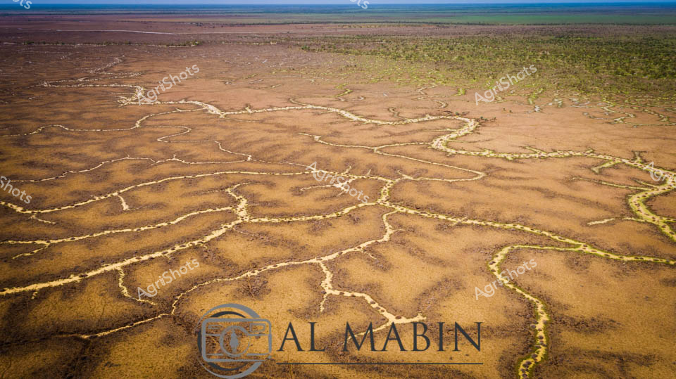
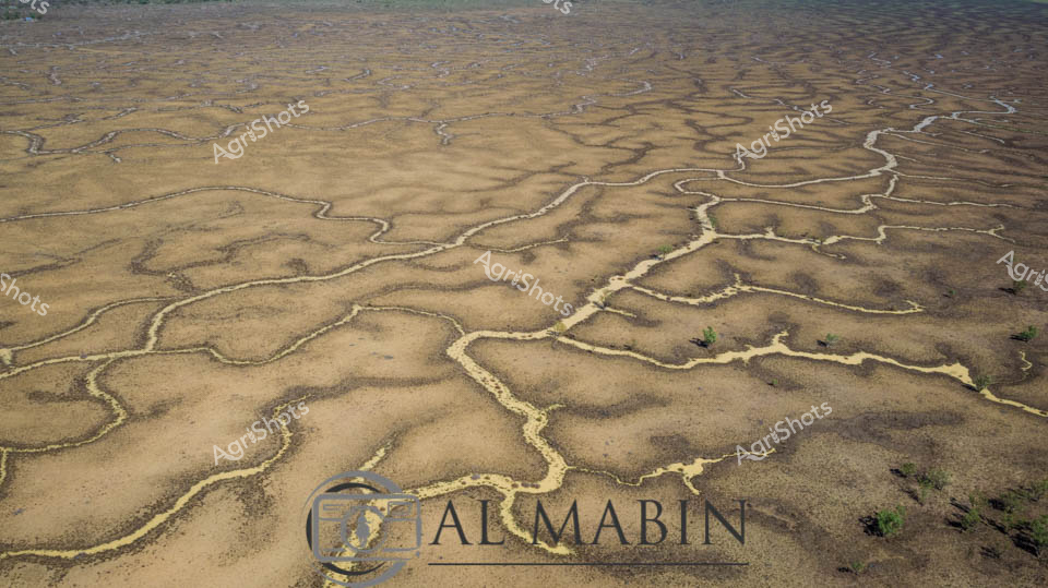
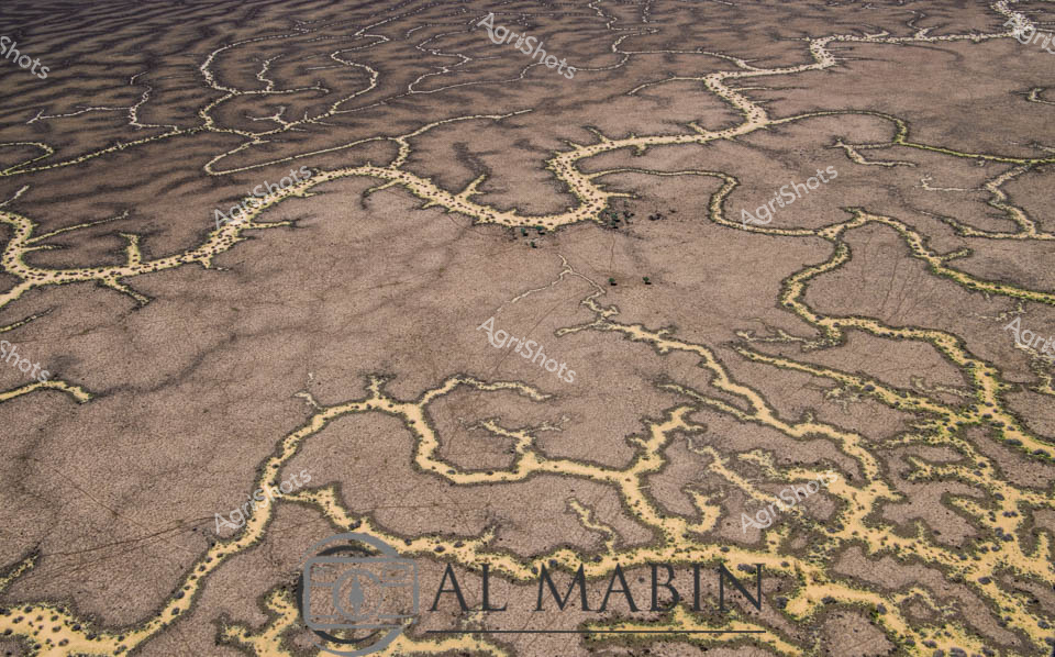
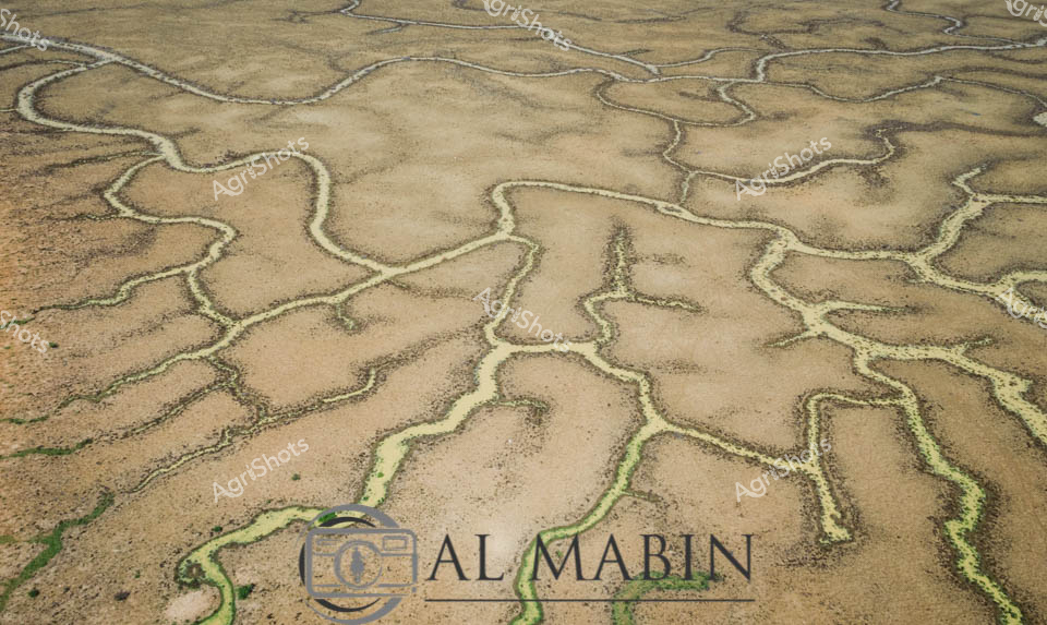
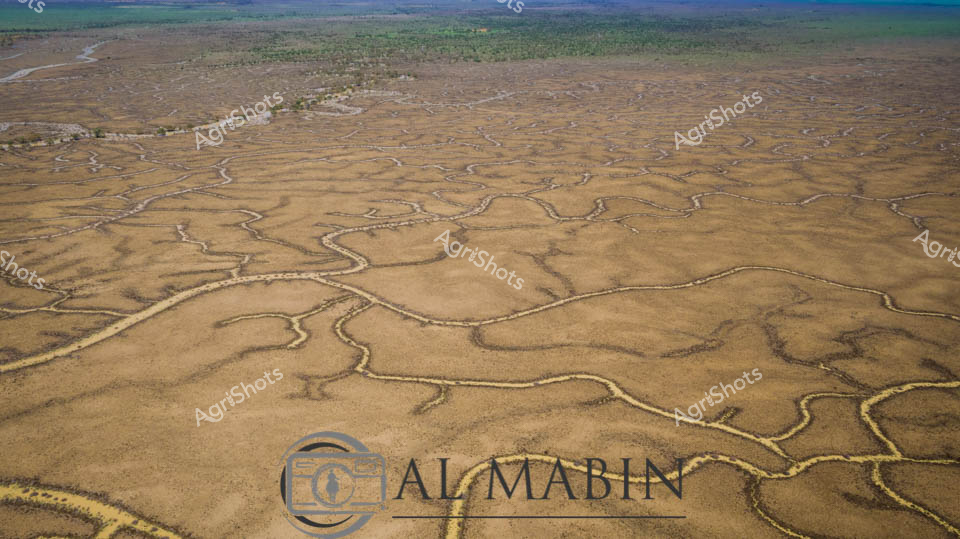
This aerial image captures an intricate network of waterways and channels winding through arid terrain, typical of Queensland's Channel Country. Sandy-colored water pathways snake between dark earth and sparse vegetation, creating a complex, maze-like pattern that reveals the dynamic hydrology of this remote landscape. The natural water distribution system demonstrates the resilient ecosystem of Australia's inland regions, with intermittent vegetation highlighting the delicate balance of water and land in this harsh environment.
 Image
Image
Meandering waterways carve intricate golden-edged channels across the parched earth of Queensland's Channel Country, revealing the dramatic hydrology of Australia's arid interior. Delicate ribbons of yellowed vegetation trace the ephemeral creek lines, highlighting the complex networks that carry precious water across this harsh landscape during rare flooding events. The aerial perspective transforms the landscape into an abstract topographical map, showcasing the resilient ecological patterns of inland Australia's beef station territories. Windorah's distinctive landscape emerges as a masterpiece of natural engineering, where water navigates through sun-baked terrain in serpentine patterns that speak to the region's extreme environmental conditions. These seasonal water flows are lifelines for remote pastoral operations, providing critical hydration for livestock and sustaining sparse vegetation in one of the continent's most challenging agricultural environments. The muted browns and subtle golden highlights capture the raw beauty of Queensland's inland watersheds, illustrating the delicate balance of survival in Australia's unforgiving outback.
 Image
Image
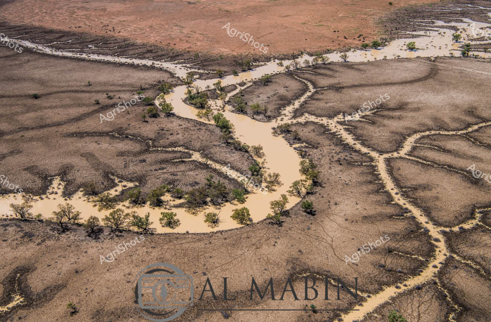
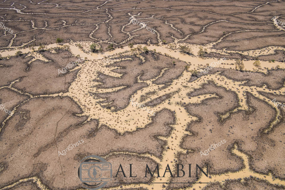
Ephemeral waterways snake through the arid Channel Country landscape, revealing the intricate hydrology of Queensland's remote beef station country. A sinuous muddy river winds between complex fractal patterns of dry earth and sparse vegetation, capturing the dramatic seasonal transformation of this harsh inland region. Windorah's characteristic terrain displays a delicate network of eroded channels and raised earth formations, testament to generations of pastoral adaptation in an unforgiving environment. Scattered native scrub and saltbush punctuate the brown and ochre terrain, highlighting the resilient ecosystem that supports extensive cattle grazing operations. The aerial perspective unveils the sophisticated natural irrigation patterns that define this unique Australian landscape, where water becomes a precious, sculpting force across hundreds of kilometers of remote pastoral land. The waterway's murky brown tone suggests recent flooding, a critical event that replenishes groundwater and triggers complex ecological renewal in this challenging agricultural frontier.
 Image
Image
Serpentine waterways thread through the arid Channel Country of Queensland, capturing the ephemeral beauty of this remote pastoral landscape. Intricate river channels meander across the ochre-brown earth, creating a complex network of water tributaries that pulse with life during seasonal flood events. The aerial perspective reveals the stunning geological artistry of natural water distribution, where each sinuous channel carves delicate pathways across the expansive floodplains. Sparse vegetation in muted greens and yellows punctuates the broader landscape, highlighting the resilient ecosystem of this harsh yet magnificent Australian outback region. Soft blue skies with gentle cloud formations stretch endlessly above the terrain, providing a luminous backdrop to the earth's remarkable hydological patterns. This extraordinary landscape represents the lifeblood of beef stations in Queensland's remote interior, where water management and natural flooding cycles are critical to sustainable pastoral agriculture.
 Image
Image
Aerial vista of Channel Country's mesmerizing landscape near Windorah, Queensland, revealing the intricate hydraulic networks carved by seasonal floodwaters across an expansive arid terrain. Serpentine waterways branch and meander through the dusty ochre plains, creating complex dendritic patterns that pulse with life-giving moisture across the seemingly barren landscape. The image captures the extraordinary resilience of Australia's inland geography, where ephemeral creek systems transform dry grasslands into temporary wetlands during rare flooding events. Subtle gradations of brown, tan, and muted green reveal the delicate ecological balance of this harsh yet breathtaking environment, where water is the critical architect of survival. Wispy clouds drift across a brilliant azure sky, providing a luminous backdrop to the textured ground below, highlighting the dramatic contrast between aridity and potential abundance. This landscape epitomizes the dramatic seasonal transformations of Queensland's remote beef station country, where water's momentary presence sculpts the very essence of the terrain.
 Image
Image
Serpentine channels of milky-tan water wind through the parched ochre landscape of Channel Country, revealing the lifeblood of this remote Queensland pastoral ecosystem. A network of ephemeral waterways branches across the arid terrain, lined with resilient remnant trees clinging to the saturated banks during a rare flooding event. The aerial perspective captures the intricate hydraulic arteries that define this harsh yet dynamic agricultural landscape, where water transforms the dusty expanses into a temporary network of life-sustaining corridors. Sparse vegetation and weathered earth tones dominate the scene, punctuated by the sinuous, almost organic flow of water that reflects the region's extreme seasonal variations. This is the raw, unfiltered essence of Australian beef station hydrology - a delicate dance between aridity and sudden abundance, where every drop of water represents survival and potential for pastoral enterprise. The Al Mabbit watermark subtly anchors this remarkable documentation of Australia's inland water systems, a critical resource for livestock and agricultural sustainability.
 Image
Image
Serpentine waterways slice through the arid landscape of Channel Country, Queensland, revealing the intricate hydraulic network of a vast inland floodplain. Blue-tinged streams meander across the ochre earth, creating a complex lacework of water channels that breathe life into this seemingly barren terrain. Yellowed vegetation clusters along the water's edges, suggesting the resilient ecosystem that emerges during seasonal flooding. The aerial perspective captures the raw beauty of this remote Australian landscape, where water transforms the dusty plains into a dynamic, interconnected system of life-giving rivers and streams. Soft gradients of brown, blue, and golden hues stretch to the distant horizon, illustrating the immense scale of this pastoral region. The image encapsulates the delicate balance of water and land in one of Australia's most challenging agricultural environments, where beef stations and natural hydrology coexist in a complex, interdependent relationship.
 Image
Image
Aerial rivers of blue snake through the parched ochre landscape of Queensland's Channel Country, revealing the intricate hydraulic network of seasonal waterways. Delicate blue threads trace sinuous paths across the arid brown terrain, creating an extraordinary natural map of water's ephemeral journey across this remote pastoral landscape. The floodplains display a remarkable geological tapestry, with meandering channels spreading like capillaries across the dry earth, capturing the dynamic relationship between water and land in Australia's inland regions. Soft yellow-green vegetation hints at the life-giving potential of these seasonal water courses, which transform the seemingly barren landscape into a complex ecosystem supporting cattle stations and native wildlife. The aerial perspective unveils nature's elegant engineering - a intricate network of waterways that appear almost like abstract artworks, revealing the hidden hydrology of this harsh yet beautiful inland terrain. This image captures the resilient spirit of Queensland's Channel Country, where water is both a precious resource and a powerful sculptural force shaping the landscape.
 Image
Image
Serpentine ribbons of golden water wind through the parched ochre landscape of Queensland's Channel Country, revealing the intricate seasonal dance of inland rivers during a rare flooding event. Delicate yellow-green waterways trace meandering paths across the dusty brown earth, creating an extraordinary living map of hydraulic arteries that breathe life into this arid pastoral region. The aerial perspective captures the extraordinary resilience of this landscape, where ephemeral waterways transform seemingly barren ground into a complex ecological system that sustains vast cattle stations and unique inland ecosystems. Subtle variations of tan, amber, and sage reveal the nuanced topography - a mosaic of drought-hardened ground interwoven with rejuvenating water channels that represent the critical lifelines of remote Australian pastoral landscapes. This extraordinary image documents the dynamic hydrology of Channel Country, where water becomes a sculptural force reshaping the terrain and supporting generations of agricultural adaptation. The photograph speaks to the fundamental rhythms of inland Australia - cycles of aridity and abundance that have shaped both the landscape and the agricultural practices of this remarkable continent.
 Image
Image
Serpentine waterways trace delicate green veins across the arid ochre landscape of Queensland's Channel Country, revealing the ephemeral life-giving networks that define this extraordinary inland ecosystem. These sinuous channels—bright emerald against the sandy beige terrain—represent the intricate river systems that periodically flood, transforming seemingly barren ground into a complex biological canvas. The aerial perspective captures the organic, branching patterns of waterways that sustain vast pastoral stations, documenting the remarkable hydrology of Australia's inland rivers during seasonal inundation. Each meandering green line represents a potential lifeline for livestock and native wildlife, highlighting the remarkable resilience of agricultural landscapes in one of the continent's most challenging environments. The Al Marin watermark subtly acknowledges the photographic documentation of this remarkable natural phenomenon, where water creates delicate, ever-changing maps across the expansive Queensland terrain. This image encapsulates the profound relationship between water, land, and survival in Australia's remote interior.
 Image
Image
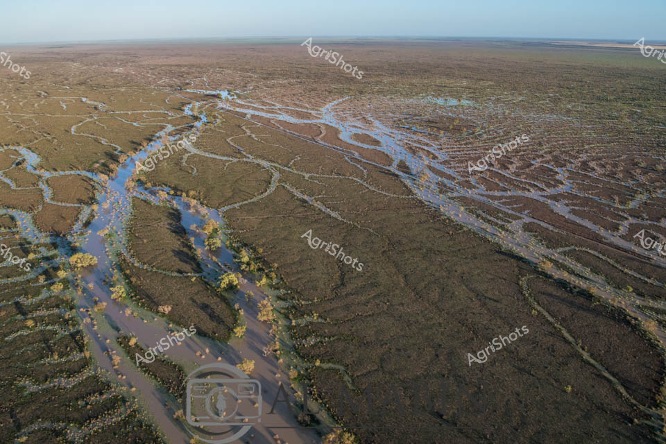
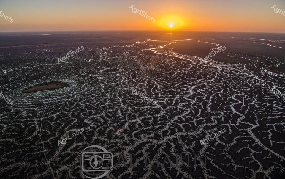
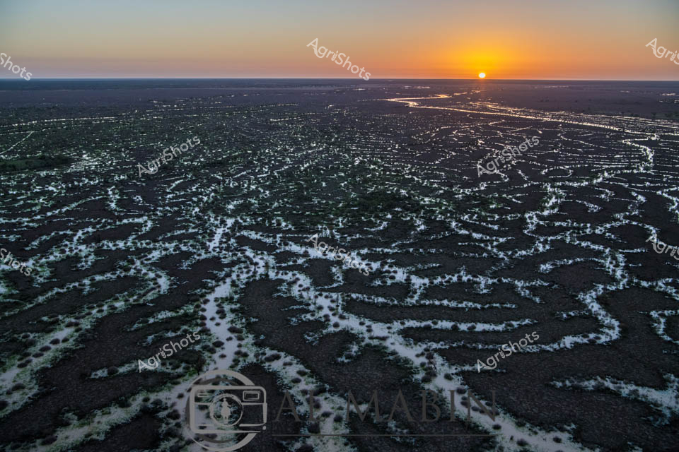
Sunrise bathes the intricate waterways of Channel Country in a golden light, revealing the mesmerizing network of braided river channels stretching across the arid Queensland landscape. The aerial perspective captures the delicate, lace-like patterns of water threading through the dark earth, creating a stunning natural mosaic that defines this unique pastoral ecosystem. As the sun crests the horizon, its warm rays illuminate the complex hydraulic system that sustains life in this remote beef cattle production region. The waterways - likely Cooper Creek or a similar inland river system - demonstrate the critical importance of water management in Australian agriculture, showing how these ephemeral water networks support extensive cattle stations during both flood and drought conditions. The intricate branching channels reflect the resilience of the landscape, with each silvery stream potentially representing a lifeline for cattle grazing in this challenging environment. This breathtaking vista encapsulates the raw beauty of Queensland's inland pastoral zones, where water is the most precious resource in a seemingly inhospitable terrain.
 Image
Image
Serpentine waterways carve intricate patterns across the arid landscape of Queensland's Channel Country, revealing the delicate lifelines that sustain pastoral ecosystems during rare flooding events. This aerial perspective captures the sinuous water channels spreading like silver veins across the sun-baked earth, transforming the typically dry terrain into a complex network of moisture and potential regeneration. The stark contrast between the rich blue sky and the muted browns and greens of the landscape highlights the resilience of this remote Australian pastoral environment, where water is the most precious resource. Windorah's distinctive riverine topography demonstrates nature's remarkable capacity to create complex hydrological systems that support livestock production and fragile dryland ecosystems. The meandering channels, likely formed by seasonal river flows, showcase how strategic water management is crucial in beef production across Queensland's challenging inland regions. This image encapsulates the raw beauty of Australia's agricultural frontier, where every drop of water represents survival and potential for pastoral sustainability.
 Image
Image
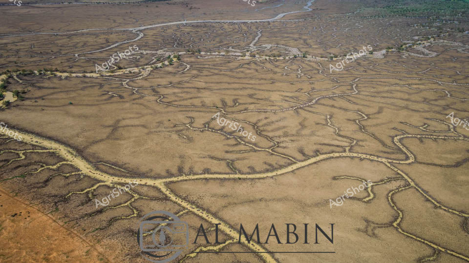
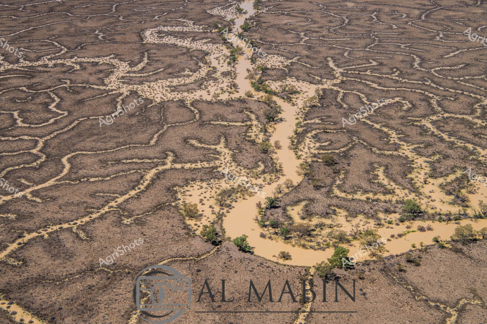
An intricate aerial view of a meandering waterway carving through arid Channel Country in Queensland, revealing the complex hydrology of a flood plain. Sandy-colored water branches across the landscape in sinuous channels, creating an organic network of waterways lined with sparse vegetation and surrounded by rich, textured earth tones. The image captures the ephemeral nature of water in this remote Australian landscape, highlighting the delicate ecological systems of inland river systems.
 Image
Image
An aerial view reveals the intricate, serpentine waterways of Channel Country in Queensland, where dry creek beds and floodplains create a mesmerizing network of sinuous lines across the arid landscape. The branching water channels, etched into the dusty earth, showcase the complex hydrology of this remote Australian region, highlighting the resilient geography that supports pastoral activities during seasonal flooding. Green vegetation clusters along the horizon, contrasting with the golden-brown tones of the expansive, water-carved terrain.
 Image
Image
Serpentine waterways carve intricate patterns across the arid landscape of Queensland's Channel Country, revealing the ephemeral beauty of desert hydrology. Golden-brown tributaries snake across a dusty terracotta surface, tracing the delicate network of ancient creek lines and seasonal river channels that define this harsh but mesmerizing ecosystem. The aerial perspective captures the geological artistry of water movement, where each branching stream tells a story of rare flooding and survival in one of Australia's most unforgiving environments. Windorah's legendary inland waterways demonstrate nature's remarkable capacity to create complex, organic designs that pulse with life-giving moisture across seemingly barren terrain. The intricate golden-edged channels suggest the transient power of water in transforming this landscape, highlighting the critical role of seasonal floods in sustaining the fragile ecological balance of central Queensland's remote pastoral zones. The AgrShots watermark andOtal Mabin branding anchor this stunning representation of Australia's inland hydrology, celebrating the raw, elemental beauty of the continent's most challenging agricultural regions.
 Image
Image
Aerial view of Channel Country's intricate water network, revealing the lifeblood of Queensland's arid pastoral landscapes. Serpentine waterways trace delicate golden-edged patterns across a weathered grey terrain, creating an organic network that resembles complex veins traversing dry earth. These ephemeral creek channels, characteristic of inland Australia's flood plains, demonstrate nature's remarkable hydraulic engineering during seasonal inundation. Soft yellowed vegetation punctuates the margins of these waterways, highlighting the subtle transition between water and land in this harsh yet resilient ecosystem. The aerial perspective captures the immense scale and fragile beauty of inland waterways that sustain vast cattle stations and support unique desert ecosystems. This landscape represents the extraordinary adaptive strategies of Australian agricultural environments, where water management is crucial to survival.
 Image
Image
Sinuous channels of water weave across the parched Channel Country landscape near Windorah, Queensland, revealing the complex hydrology of this remote pastoral region. Seasonal floodwaters from distant rainfall trace intricate pathways through the golden-brown grasslands, creating natural irrigation networks that sustain cattle stations and delicate ecosystem dynamics. The aerial perspective highlights the meandering waterways, their pale edges contrasting against the dried earth, showcasing the resilience of Australian pastoral landscapes during dry seasons. Sparse vegetation and undulating terrain demonstrate the challenging environmental conditions that define beef production in Australia's inland territories. The Al Mabin watermark suggests this is a professionally captured agricultural documentary image, offering an intimate glimpse into the sophisticated natural systems that support remote livestock operations. The soft ochre and amber tones communicate the arid beauty of Queensland's interior, where water is both precious and transformative.
 Image
Image
Serpentine waterways carve intricate patterns across the arid landscape of Queensland's Channel Country, revealing the delicate hydraulic infrastructure of Al Mabin station. Aerial perspectives showcase the complex network of ephemeral creek channels, their pale edges contrasting against the ochre and dusty brown earth, creating a natural irrigation system that sustains this remote beef cattle pastoral region. The intricate branching waterways resemble delicate veins across the landscape, capturing the precious moisture essential for survival in this harsh Australian outback environment. Distant green vegetation marks the edges of the floodplain, while a bright blue sky with scattered white clouds offers a sense of expansive tranquility and timeless geological process. This remarkable image captures the nuanced relationship between water, land, and pastoral agriculture in one of Australia's most challenging yet productive agricultural landscapes. The natural drainage patterns demonstrate how strategic water management enables cattle production in an environment where every drop of water is a lifeline.
 Image
Image
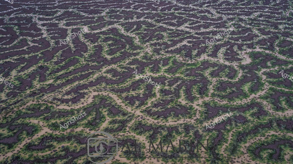
Aerial panorama of Channel Country's intricate water channels near Windorah, Queensland, revealing the mesmerizing natural irrigation patterns of arid western landscapes. Deep purple-brown earth intertwines with delicate green vegetation, creating an organic, lace-like topography that demonstrates the resilient ecosystem of Australia's inland waterways. Serpentine waterways trace complex networks across the terrain, highlighting the ephemeral nature of water in this challenging environment, where every drop is precious for sustaining pastoral life. The seasonal flooding has transformed the stark landscape into a vibrant, interconnected system of life-giving channels, showcasing the remarkable adaptation of both landscape and agricultural practices to extreme climatic conditions. Soft sandy edges blend with dark soil and scattered greenery, creating a natural camouflage that speaks to the subtle beauty of Queensland's remote interior. This breathtaking aerial perspective captures the delicate balance between aridity and abundance in one of Australia's most distinctive agricultural regions.
 Image
Image
Aerial vista of Channel Country in Queensland during peak flood season, a mesmerizing landscape of interconnected waterways and verdant floodplains stretching to the horizon. A solitary elevated landmass—likely a cattle station's strategic high ground—emerges like an island sanctuary amidst the expansive blue-green aquatic terrain. The intricate network of water channels weaves between sparse vegetation, creating a mosaic of azure and olive hues that characterize this unique Australian inland ecosystem. Seasonal flooding transforms the arid landscape into a dynamic, life-sustaining environment, critical for supporting cattle grazing and native biodiversity in this remote region. The subtle undulations of the terrain reveal the complex hydrology of Channel Country, where water becomes the defining element of survival and agricultural potential. This breathtaking aerial perspective captures the raw, untamed beauty of Queensland's inland waterways, showcasing the resilience and adaptive nature of Australia's agricultural landscapes.
 Image
Image
Serpentine waterways thread through the arid Channel Country landscape, capturing the ephemeral beauty of flooding season in remote Queensland. Intricate blue-brown rivulets carve delicate patterns across the parched earth, revealing the dynamic hydrology of this harsh pastoral region. Small stones and pebbles line the sinuous water channels, creating natural borders that highlight the water's meandering journey across the station's expansive terrain. The aerial perspective transforms the landscape into an abstract canvas, showcasing how water transforms this typically dry landscape into a complex network of life-giving streams. Subtle variations of brown, tan, and blue tones create a mesmerizing topographical map that speaks to the resilience of Australia's inland ecosystems. This extraordinary image captures the fleeting moment when flood waters breathe temporary life into the seemingly barren outback, illustrating the critical role of seasonal water flows in sustaining pastoral lands and indigenous ecological systems.
 Image
Image
Aerial View of Channel Country Floodplains near Windorah, Queensland Serpentine waterways slice through an emerald and azure landscape, revealing the breathtaking hydrology of Queensland's remote Channel Country. Seasonal flood waters have transformed the arid terrain into a complex network of blue channels and verdant green vegetation, creating a mesmerizing mosaic of ecological renewal. A solitary vegetated island rises from the watery expanse, its golden-green trees standing resilient amid the liquid geography of this expansive pastoral region. The intricate water patterns demonstrate the cyclical life-giving power of seasonal flooding, crucial for sustaining cattle stations and native ecosystems in this harsh inland environment. Subtle variations of blue, green, and ochre merge and intertwine, showing how water reshapes the landscape, replenishing soil and supporting pastoral agriculture in one of Australia's most demanding agricultural zones. This aerial perspective captures the raw, elemental beauty of outback Queensland, where water is the primary architect of survival and regeneration.
 Image
Image
Aerial view of an intricate natural waterway system winding through the arid Channel Country of western Queensland, revealing the complex hydrology of this remarkable landscape. Sinuous green-edged channels break through the dusty golden-brown earth, tracing delicate networks that resemble capillaries across a vast, sun-baked terrain. These ephemeral creek lines, characteristic of the region's seasonal flooding patterns, demonstrate the resilient ecosystem of Australia's inland waterways, where brief moments of rainfall can transform seemingly barren landscapes into thriving, interconnected waterways. The image captures the fragile balance of water and land in one of Australia's most challenging agricultural environments, where pastoral stations rely on these natural water distribution systems for livestock survival. Subtle variations in earth tones - from pale ochre to rich sepia - highlight the textural complexity of the landscape, while the thin green margins of vegetation hint at the life-giving potential of these intermittent water courses. The Al Mabin watermark signals this as a professional aerial documentation of Queensland's extraordinary natural geography.
 Image
Image
Intricate braided waterways snake across the sun-baked earth of Channel Country, revealing the ephemeral hydrology of Queensland's vast inland landscape. Aerial perspective captures the delicate silver-white tendrils of seasonal creek networks meandering through an ochre and taupe terrain, tracing the subtle topographical contours like fine veins across a dried riverbed. These seasonal water channels, characteristic of Australia's arid interior, demonstrate the resilient ecological patterns of flood plains that briefly come alive during rare rainfall events. Windorah's legendary landscape unfolds in this image - a testament to the dynamic hydraulic systems that sustain pastoral ecosystems across remote western Queensland. Sparse vegetation punctuates the margins of these water pathways, highlighting the sparse yet strategic vegetation adapted to survive in these extreme environmental conditions. The Al Mabin watermark signals this as a professionally captured documentation of Australia's remarkable inland geographical phenomena, celebrating the raw beauty of pastoral landscapes that define the continent's agricultural heartland.
 Image
Image
Serpentine waterways slice through the arid Channel Country landscape, revealing the intricate hydraulic networks of a Queensland cattle station during seasonal flooding. Sinuous blue channels meander across the brown earth, creating a complex arterial system that transforms the seemingly barren terrain into a dynamic, life-sustaining environment. The aerial perspective captures the remarkable geological patterns formed by water movement, with delicate blue streams branching and intersecting across the expansive, ochre-toned plains. These ephemeral water channels are critical to the survival of extensive beef cattle operations in this harsh central Queensland region, providing essential moisture and creating temporary grazing zones for livestock. The landscape demonstrates nature's extraordinary capacity to reshape and renew, with the flooding bringing crucial nutrients and regenerative potential to this remote pastoral ecosystem. The horizon stretches endlessly, revealing the immense scale of Australian agricultural landscapes where water management is a critical survival strategy.
 Image
Image
Aerial view of Channel Country's intricate waterways near Windorah, Queensland, revealing the mesmerizing natural irrigation system of this arid pastoral landscape. Sinuous blue channels weave through the russet-brown earth like delicate silver threads, tracing the ephemeral path of seasonal floodwaters across the expansive plains. The landscape transforms into a complex network of braided streams, creating natural water distribution channels that sustain sparse vegetation and support extensive beef cattle stations during rare flooding events. Soft blue skies blend with the earthy tones of the terrain, highlighting the stark beauty of Australia's inland waterways and the remarkable adaptability of its agricultural ecosystems. These natural water management systems demonstrate the intricate relationship between water, land, and livestock survival in one of the continent's most challenging agricultural environments. The photograph captures the subtle resilience of Channel Country - a testament to the sophisticated hydrological patterns that enable pastoral agriculture in remote Queensland's unforgiving landscape.
 Image
Image
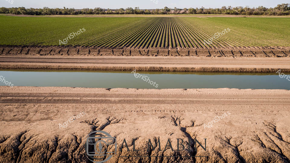
Precision-engineered agricultural landscape reveals the intricate relationship between water, soil, and cultivation in Australia's expansive Channel Country. Geometrically perfect crop rows stretch across the horizon, transitioning from deep emerald to lighter green, bisected by a precisely engineered irrigation channel filled with soft, reflective water. The foreground displays eroded earth textures, revealing the challenging terrain's complex topography - carved channels and mineral-rich sedimentary patterns tell a story of water's transformative power across this arid landscape. Laser-straight irrigation channels demonstrate sophisticated farming techniques adapted to Queensland's harsh environmental conditions, where every drop of water is strategically channeled to maximize agricultural productivity. The linear perspective creates a mesmerizing visual rhythm, highlighting human intervention in shaping seemingly untameable landscapes. Distant treelines provide a muted green boundary, suggesting the delicate ecological balance maintained through careful land management. This panorama captures the essence of Australian agricultural resilience - a testament to engineering, environmental understanding, and the relentless pursuit of sustainable food production in challenging terrain. The image speaks to generations of agricultural innovation, where precise water management transforms potentially unproductive landscapes into thriving agricultural ecosystems.
 Image
Image
Branching waterways weave an intricate network across the parched Channel Country landscape, revealing the ephemeral lifelines of Queensland's remote interior. Limestone-edged creek lines trace delicate golden-green pathways through ochre and umber plains, capturing the subtle hydrology of an arid pastoral ecosystem. During rare flood events, these seemingly fragile watercourses transform the landscape, carrying vital moisture across vast cattle station territories and sustaining native grasses that support extensive beef production. The aerial perspective unveils a natural irrigation system where water navigates subtle topographical contours, creating a mesmerizing organic pattern that speaks to the resilience of Australia's inland agricultural environments. Soft green vegetation clusters along the watercourse edges contrast with the dominant brown earth, highlighting the critical role of water in this unforgiving terrain. The Al Mabin watermark signals this as a professional agricultural landscape documentation, capturing the strategic beauty of Queensland's remote pastoral zones.
 Image
Image
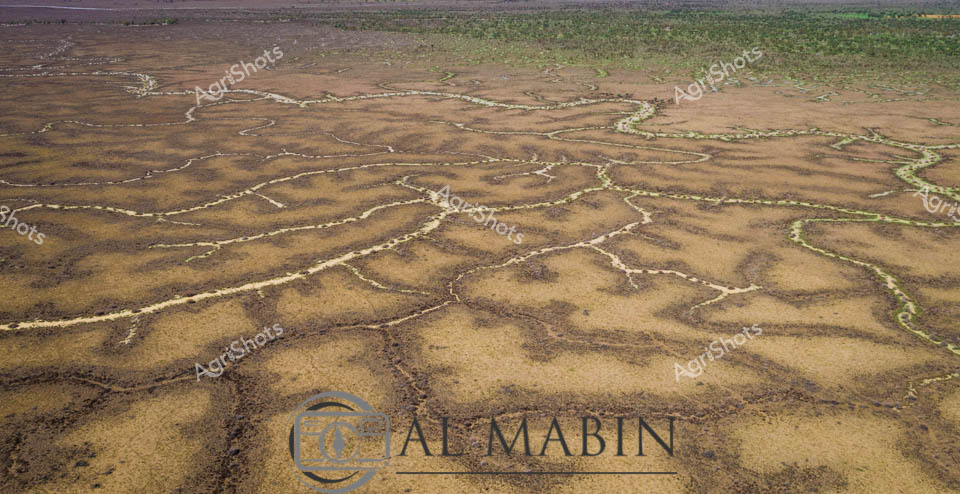
Aerial view of Australia's mesmerizing Channel Country, revealing an intricate network of ephemeral waterways carved across the arid landscape near Windorah in Queensland. Delicate branching patterns of pale sand and sediment contrast against the dark earth, creating a natural topographical map that traces the fluid dynamics of seasonal flooding. These sinuous channels - remnants of recent river flows - showcase the extraordinary hydraulic choreography of inland water systems, where every rainfall creates temporary arteries across the drought-prone terrain. The landscape appears almost fractal in its complexity, with each tributary and rivulet telling a story of water's transformative power in this harsh agricultural region. Soft green and brown tones blend subtly, highlighting the resilience of this ecosystem where pastoral stations manage cattle across massive, unpredictable landscapes. This extraordinary aerial perspective captures the raw beauty of Queensland's inland waterways, revealing the intricate geological and hydrological processes that define Australia's remarkable agricultural frontier.
 Image
Image
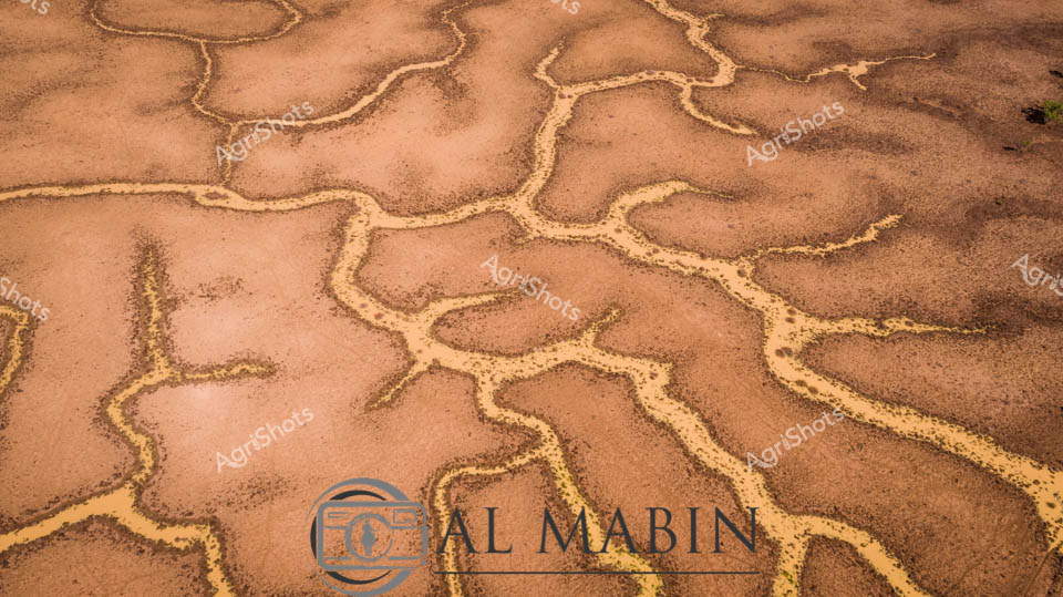
Aerial watershed mapping reveals the intricate hydrology of Channel Country in remote Queensland, where ephemeral creek systems snake across arid landscapes like delicate silver veins. Sandy-colored flood channels spread in mesmerizing fractal patterns, capturing the transient water movements that sustain this harsh inland ecosystem. Sparse vegetation clusters along the lighter sandy ridges, contrasting against the weathered brown earth, demonstrating the remarkable resilience of desert flora. The waterways, etched into the landscape like ancient arteries, illustrate the complex hydrology that supports pastoral operations in this challenging environment. Al Mabin's photographic documentation captures the subtle beauty of Australia's inland water systems, revealing how these seemingly barren terrains pulse with intricate life-sustaining networks during rare flooding events. The image is a testament to the geological and ecological sophistication of Queensland's remote beef station regions, where water management is critical to survival.
 Image
Image
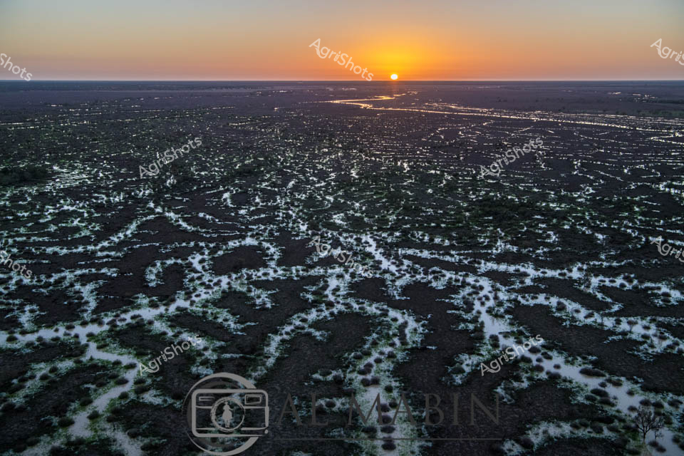
Dawn breaks over Channel Country's mesmerizing landscape, revealing an intricate network of ephemeral waterways stretching across dark earth at sunrise. The braided creek systems of western Queensland glow with silvery-white ribbons of water, creating an extraordinary natural irrigation pattern that transforms the arid landscape into a complex hydological tapestry. Soft golden light crests the horizon, illuminating the serpentine water channels that wind through the dark soil, capturing the essence of this remote Australian inland ecosystem. These seasonal flood plains, characteristic of Queensland's western regions like Windorah, demonstrate nature's extraordinary capacity for water distribution across seemingly inhospitable terrain. The aerial perspective highlights the delicate balance of water and land, where each sinuous stream represents potential life and regeneration in this challenging agricultural environment. The image captures the raw, elemental beauty of Australia's interior - a landscape of extreme conditions where water is both rare and transformative.
 Image
Image
Aerial view of a braided network of water channels traversing an arid landscape, characteristic of Queensland's Channel Country. Intricate golden-yellow waterways wind and meander through a weathered grey-brown terrain, creating a natural map-like pattern that reveals the complex hydrology of this remote Australian landscape. The dry season's parched earth contrasts with the delicate veins of water, highlighting the resilience and dynamic nature of inland river systems during flood events. Subtle green vegetation edges the water channels, providing a hint of life in this otherwise stark environment. The image captures the essence of remote pastoral landscapes, where water management and seasonal flooding are critical to the survival of cattle stations and the unique ecosystem of inland Australia. This aerial perspective offers a stunning visualization of the intricate water distribution networks that define the breathtaking Channel Country region near Windorah in Queensland.
 Image
Image
Golden Dawn over Channel Country Floodplains Sunrise bathes the expansive Channel Country landscape in ethereal light, revealing the intricate network of braided waterways and flooded grasslands characteristic of Queensland's remote western regions. Dark earth and silvery water intertwine in complex, vein-like patterns stretching to the horizon, creating a mesmerizing topographical tapestry that speaks to the dynamic hydrology of Australia's inland river systems. The early morning sun emerges as a perfect golden orb, casting warm amber and orange hues across a flat, seemingly infinite landscape that epitomizes the raw, elemental beauty of outback Australia. These seasonal floods are crucial for regenerating pastures, supporting livestock grazing, and maintaining the delicate ecological balance of this arid agricultural zone. The image captures the precise moment when dawn transforms the landscape, illuminating the water-saturated terrain with a luminous, almost ethereal quality that highlights the resilience and adaptability of pastoral ecosystems. This aerial perspective reveals the sublime complexity of Australia's inland waterways, where water is both a precious resource and a transformative environmental force.
Well, you've ploughed through the whole field!
No more crops to harvest here, mate.
Try searching for something else in our library of 50,000+ royalty-free media: